Excerpt from The Roustabout Issue #37 Published by the Delaware, Lackawanna, and Western Railroad Historical Society, Inc. Spring 2020
On August 1, 1913, a cloudburst formed just west in the community of Pen Argyl, PA around 4 pm. The cloudburst crossed the Delaware River and caused extensive damage in its path, and after it passed, six railroads including the Delaware, Lackawanna and Western had washouts. The newly created New Jersey Cut-Off withstood with no damage, however, the DLW's Old Main and the Pennsy's Belvidere and Delaware Branch both received extensive destruction. About 200 feet of the Pennsy's track was washed away and crumbled down to the public highway below, causing the tower and the freight station to both topple with the mountainside. The tower operator, however escaped without harm. As a result of the flooding, both railroads were blocked and experienced numerous track washouts, along with a 50 foot gully through the roadbed. The ‘Pocono Special’, a train run by the Pennsy from Philadelphia was blocked at the site and had to turn back for Easton PA. Nearby hotels and resorts were badly damaged, resulting in power outages and broken water mains. No lives were lost in the calamity, which was estimated to cause more than $100,000 in damages (in 1913 dollars). Local news reports said the worst damage was centralized to Manunka Chunk, where wire communication became near impossible. The Bangor and Portland Branch also lost seven bridges during the storm, causing all trains to be stranded in Portland. (Copied from Todd’s Railfan Guide)
This, however was not the first major washout here. When the Warren RR was built, a stream, Catherine’s Run, was severed during the construction of the cut at the east side of the Manunka Chunk tunnel. The stream was diverted with a wooden flume to carry the stream under the track through iron pipes and down the mountainside.
The first reported major washout to happen there was on July 23, 1887 when a storm overwhelmed the flume with a torrent of water going through the tunnels and causing a collapse of the embankment at the west end of the tunnels. At the base of the embankment, the home of the agent, George Fox was severely damaged and resulted in the death of his wife and her guest. There was another incident on February 5, 1896 when the embankment again slid down as the result of a snow and rain storm. The worst incident was the storm of August 1, 1913 as described earlier when Catherine’s Run swelled and over ran the flume with the resulting torrent of water surging through both portals of the Manunka Chunk tunnel with the resulting described damage.
The following series of postcard shots are from the August 1st, 1913 flood. There have been the frequently seen photos of the aftermath of the flooding in publications over the years. In the 1987 book The Lackawanna Railroad in Northwest Jersey by Larry Lowenthal and William T. Greenberg, Jr published by The Tri-State Railway Historical Society, Inc., there were several different photographs of the aftermath on page 35. The map below came from page 43 of that above referenced book. Please refer to the following map for reference with the postcards.
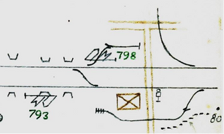
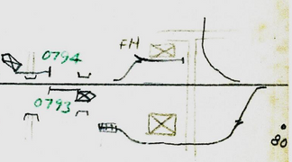
Shown below are two track diagrams of the DL&W and the PRR Bel Del Division junction after the 1913 flood with the interlocking tower moved the new location against the mountain closer to the actual track interchange.


Views of Manunka Chunk Action
The following series of photos are from cabinet photos from 1895-1905 that I borrowed in the 1970s from two individuals when I was writing “The History of The Blairstown Railway”. They were Eloise Lehnert, who worked as a reporter for many years at the Blairstown Press and Larry Smith who lived in Delaware, NJ. The originals have since disappeared with the passing of time. These are of the Manunka Chunk Station area of both DL&W and PRR passenger trains and station workers. Notes were faintly written on the backs of the photos


The Changing Delaware, NJ Station Scene
The following cabinet photo and postcard views of the DL&W station area in Delaware,
NJ were taken from virtually the same location at Blair Knob that over looked the area span from the 1890s to the 1920 timeframe. It’s interesting
The first view shows the station, freight house, water tank surrounded by a square enclosure, ancillary buildings, a second rectangular building adjacent to the tracks directly opposite the water tank, cattle pen and in the distance on the right Hoyts factory that made gun stocks during World War I.
The second view shows the station, freight house, water tank sans the enclosure, smaller cattle pen and Hoyt’s factory. Missing are the
ancillary buildings between the freight house and the water tank and the rectangular building that was directly across from the water tank.
The third and last view shows the station and freight house, cattle pen, and Hoyt’s factory. Now missing is the water tank.
The only thing that helps date the two postcards to prior to 1928 is that there is no evidence of Route 6 (now Rt 46) which was constructed starting in 1928 after the NYS&W Delaware Branch was abandoned and removed mid 1928.

Hand drawn maps by Harry T Wilhelm of the Delaware area from the late 1920s to early 1950s showing changing configuration. Dotted line on top map indicated the former NYS&W ROW. The top map shows the DL&W main as double track with the creamery and sand pit sidings. The bottom map shows the line as being single tracked and still with the creamery and sand pit sidings. (Bob Bahrs collection)


コメント